|
Independence Wednesday 31st Octr. [Traveled 10 miles from Blue River near Buckner to Independence, Missouri.] Left encampment this morning at half after 7 o’clock - the company under Capt. Hull being attached to the emigration - and at 12 o’clock passed through Independence. At 1 we reached our present encampment two miles south of Independence, and 10 miles from the camp of yesterday. After reaching camp in the evening a small quantity of shoes were distributed among the emigrants. Many Indians came into camp during the afternoon much intoxicated. Go about 10 miles and turn west (left) on E. Truman Road. Follow Truman Road about 15 miles into Independence. Turn south (left) on Noland Road, then turn (west) right into Pioneer Spring Park. There is a log cabin museum and you can look through the windows to see the exhibits. The Trail of Death marker is across the sidewalk from the front door of the cabin. It is the only marker that has wording on both sides. There is a ring made of bricks for programs and dances a few feet from the cabin. It has benches. 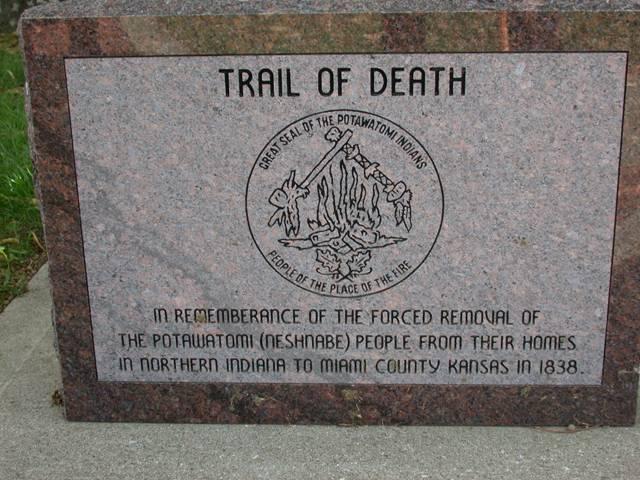
Located in Pioneer Spring Park on Truman and Noland roads at the east side of Independence. Erected by Boy Scout Matt Moreno for Eagle award, with assistance by Maryann Frank, Regional Representative of Citizen Band Potawatomi, in 1993. (Photo by Larry Prichard, Lynn, Indiana, on Trail of Death Commemorative Caravan, 2003.) 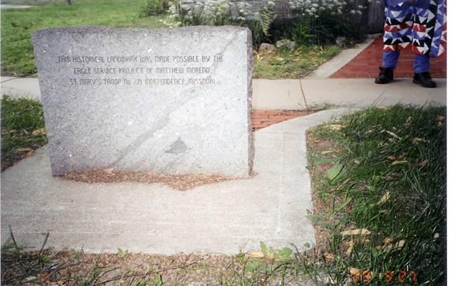
This is the only Trail of Death marker which has wording on the back. Located in Pioneer Spring Park on Truman and Noland roads at the east side of Independence. Erected by Boy Scout Matt Moreno for Eagle award, with assistance by Maryann Frank, Regional Representative of Citizen Band Potawatomi, in 1993. (Photo by Dolores Grizzell, Winamac, Indiana, on Trail of Death Commemorative Caravan in 1998.) 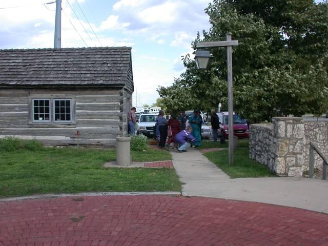
The log cabin museum at left faces the Trail of Death marker, which Dolores Grizzell is kneeling in front of. The brick circle is in the foreground - it is for programs and dances. (Photo by Larry Prichard, Lynn, Indiana, on Trail of Death Commemorative Caravan, 2003.) Leave Independence by going south on Noland Road. |
| < Previous | Home | Next > |