|
Napoleon Arriving in Napoleon on highway 224 from Wellington, turn west on 2nd Street and the Trail of Death marker is in the town park on the north (left). It is beside a pavilion with picnic tables. The marker is a sign on the pavilion above a white rock. 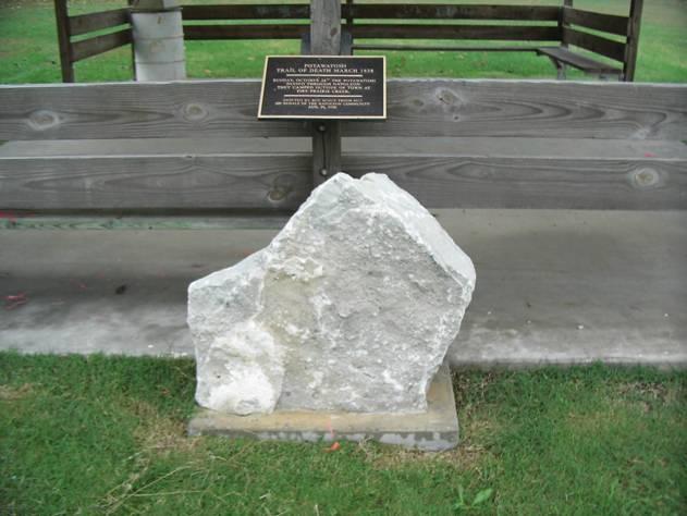
Located in town park on 2nd Street. Erected in 2000 by Boy Scout Jason Shirk for Eagle award. (Photo by Bill Willard, 2004)) The diary does not mention Napoleon, Missouri, but the Trail of Death must have passed on the roads that now pass through this little town, because it is on the route. Therefore a Boy Scout chose to erect a marker there. 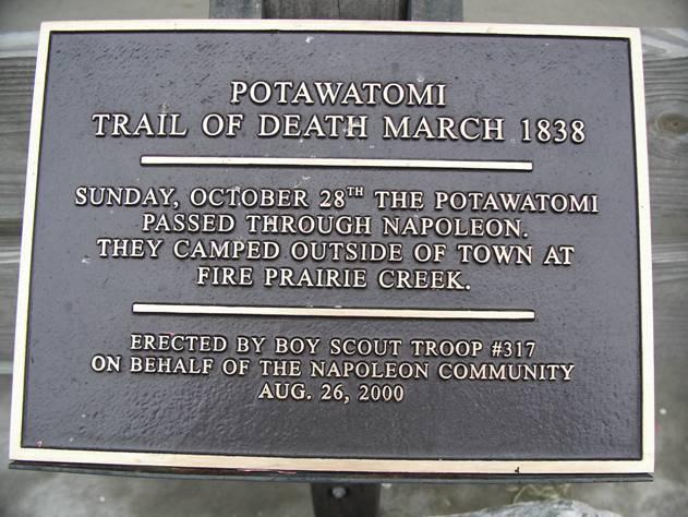
Close up of Trail of Death marker fastened to pavilion in town park, located on 2nd Street, just west of 224. (Photo by Bill Willard, 2004)) Leave Napoleon by getting back on 224 and turning south (right). Follow 224 to US 24 and turn west (left) on 24. |
| < Previous | Home | Next > |