|
Approaching Richmond from the east, stay on 10 (do not exit on Old 10) until coming to South Street. Turn west (right) on South Street and go about a mile to Richmond High School, which is on corner of South Street and highway 13. The Trail of Death marker is on the school lawn next to the street and some trees. There is a McDonald’s restaurant on the corner. Thursday 25th Octr. [Traveled from Carrollton to Richmond, Missouri.] Having an unusually long journey before us, across a prairie, we moved from Carrollton encampment at half past 7 o’clock and without meeting with difficulties or obstructions, but somewhat fatigued, we arrived at Snowden’s near whose farm we encamped. Journey was made long by scarcity of water and timber and the absence of provisions and forage. Some time after our encampment the Conductor was waited upon by a gentleman, who it appeared had been delegated by the citizen of Richmond (a village near us) to request assistance as they really anticipated an attack from the Mormons tonight. Judge Polke informed the gentleman that such a step on his part would be entirely without the line of his duty. His duties were particularly delegated to him by the government, to which he was responsible for the faithful performance of the same. He hoped that the excitement would abate, and the aid which he required be rendered unnecessary. Provisions and forage as usual. 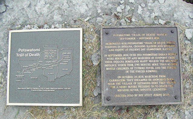
Located on Richmond High School grounds next to the street. The boulder and metal plaque at the right were erected by Boy Scout Joe Davis for his Eagle award. The metal plaque with the map at the left was added in 2003 by friends of Trail of Death Regional Historic Trail and Friends of the Ray County Museum. The map was made by Tom Hamilton on his computer; he is Potawatomi descendant of Abram Burnett who was on the Trail of Death. (Photo by Bill Willard, 2004) 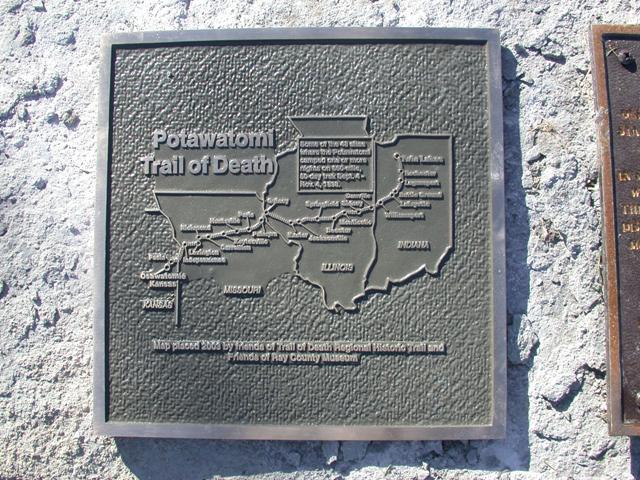
Close up of the map plaque. Erected in 2003 by friends of Trail of Death Regional Historic Trail and Friends of the Ray County Museum. The map was made by Tom Hamilton on his computer; he is a member of Citizen Potawatomi Nation and a descendant of Abram Burnett who was on the Trail of Death. (Photo by Larry Prichard, Lynn, Indiana, on Trail of Death Commemorative Caravan, 2003.) Leave Richmond by going south on highway 13, crossing highway 10, passing by Henrietta and continuing on 13 to Lexington. |
| < Previous | Home | Next > |