|
Riddle Hill is west of Springfield, Illinois, on the Old Jacksonville Road. Saturday 29th Sept. [Traveled 17 miles from east of Springfield to McCoy’s Mills, near Riddle Hill, Illinois.] After passing through Springfield, we continued on. At 3 we made camp at McCoy’s Mills and a stream with little water. Dr. Jerolaman on account of his continued indisposition, requested leave to remain in Springfield a few days to recruit. Permission was granted. Our march today was through a very dry region of the country. We are now encamped on a stream affording little water. 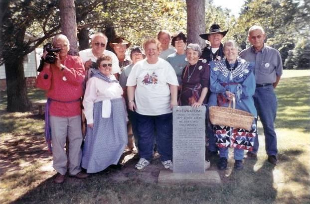
Riddle Hill, Illinois - Old Salem United Methodist Church. GPS N-3946913 W-8946773. Located west of the Old Salem United Methodist Church, this marker faces the Old Jacksonville Road west of Springfield, Illinois. The 2003 Trail of Death Commemorative Caravan paused for a picture. From left: Tom Hamilton, Larry and Rose Prichard, Bob Pearl, Ilah Alsop, Janet Pearl, Patrick Dockry, Mary Ann Dockry Harty, Sister Virginia Pearl, Bill and Shirley Willard, Galen Kabance. (Photo by Dolores Grizzell, 2003.) 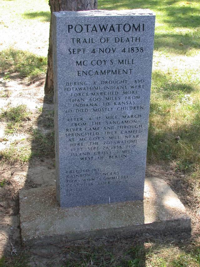
Riddle Hill, Illinois - Old Salem United Methodist Church. GPS N-3946913 W-8946773. The actual Trail of Death camp site was McCoy’s Mills, which was located 2 miles west of this marker on Farley Road and Little Spring Creek. As that was a gravel road that was not traveled much, Jennifer Kansy, head of the Rainbow Dancers project committee, decided to put the marker here on the highway and got permission from the church upon whose grounds it sits. This is on Old Jacksonville Road west of Springfield. Erected 1996 by Rainbow Dancers Pow Wow. (Photo by Bill Willard, 2004.) |
| < Previous | Home | Next > |