|
Side Trip - Harrison Trail marker - this old Indian trail was used by General William Henry Harrison and his army on its way to and from the Battle of Tippecanoe in November of 1811. The trail is still visible on the east side of the Alan Switzer residence extending north and south. It is believed that two or more of Harrison's soldiers are buried in the Gopher Hill Cemetery as they died on the march back to Vincennes, Indiana, capital of Indiana Territory 1800-1813. Harrison was Territorial Governor until Indiana became a state in 1816. 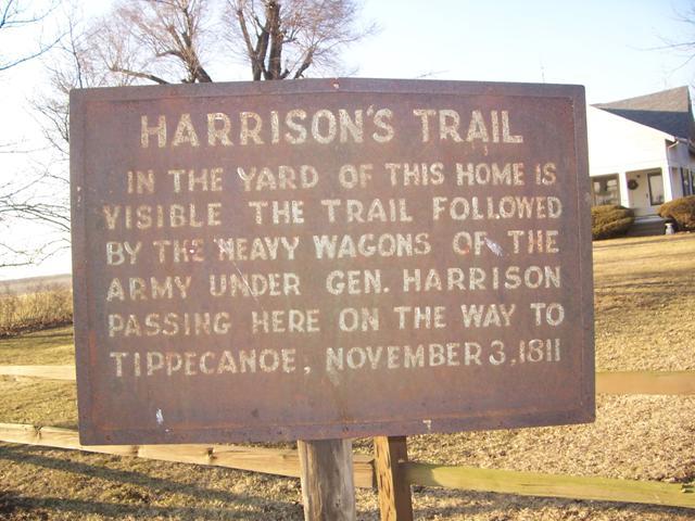
Near State Line City, Indiana - Harrison Trail marker in front yard of Alan Switzer, located at 9914 W and 825 S. GPS: N-4011405 W-8730211. The sign was erected by Tri-County Historical Society c. 1930. Harrison Trail, taken from Fountain & Warren Counties, Indiana, by Thomas A. Clifton, Indianapolis, 1913: "When General Harrison left Vincennes in November, 1811, to proceed against the Indians in what is now Tippecanoe county, and which campaign resulted in the triumphant battle of Tippecanoe, on the morning of November 7, 1811, he took between eight and nine hundred soldiers of the United States army and marched under the guide and trusty scout, Zachariah Cicott. He entered what is now known as Mound township, Warren county, thence passed northward through Kent township, encamping first (in this county) in a small detached grove, and there on his return trip, after the battle, buried two or three soldiers who had been wounded at Tippecanoe. Their resting place is at what is now called Gopher Hill cemetery, about two miles to the southeast of State Line village. From that point the army resumed their march northeast and passed by the huge boulder, which until recent years stood in the highway, on the old Hunter farm, between sections 19 and 30, township 21, range 9 west. The second encampment in the county was made just across the Big Pine creek, east, and "about eleven miles from its mouth into river Wabash." This is known now as "Army Ford" and there seems to be two theories as to where the army really did cross this creek, but the generally accepted one is that his crossing was made above where Honey creek comes into Big Pine creek, and in the center of section 9, township 22, range 8 west, on lands now owned by Scott Brier, a descendant of one of the first settlers, and who, with his neighbors, has always called this the crossing place of the army. It is in Liberty township. This seemed to be the belief of Judge Isaac Naylor, who wrote on this theme many years ago, and he was with Cicott after the war of 1812 and went over the trail and noted the camping places. "The other theory (we give it for what it is worth) is that it was in the southwest quarter of section 4 in the same township and range, less than a mile to the northwest. But there seems little good evidence that this is correct. "From that point -"Army Ford", wherever that may have been- the line of march was taken up and pursued in the northeastern direction, directly to where the battle was fought in Tippecanoe county, passing through the corner of Pine township, diagonally northeast through Adams township, cutting the northwest corner of Medina township, thence on into Tippecanoe county. "It should be added that on the march back from Tippecanoe to Vincennes, Harrison lost a man named Drummond, who was buried near the camping place on Big Pine creek ....this soldier, with probably the three buried at what is Gopher Hill cemetery, were the only ones who died from wounds en route to Vincennes...." Counties of Warren, Benton, Jasper and Newton Indiana Historical and Biographical Illustrated, 1883: "His army entered the county (Warren) in the southwestern part of Mound Township, thence passing northeastward through Kent about a mile east of State Line City, thence on through Steuben and southwestern Jordan, and possibly northwestern Pike, thence on diagonally on through the center of Liberty, crossing Big Pine Creek about a mile and a half northeast of Carbondale, at a place known as the "Army Ford," thence on through Adams and Medina Townships and into northern Tippecanoe County...... The army encamped in Warren County first in Kent Township, in a detached grove, where two of the men died and were buried. The spot is used now as the Gopher Hill Cemetery. Much of the route of the army lay along an old Indian trail, and as it was afterward traveled considerably, it was worn so deep that it can yet be traced in the county some ten or twelve miles. In the door yard of G.H. Lucas (now Alan Switzer) who lives about a mile east of State Line City, the trail is at least a foot deep and five or six yards wide. The army also encamped on the east bank of Big Pine Creek immediately after crossing the stream." --Information from Terry Wargo, Warren County Historical Society, and librarian at West Lebanon, Indiana. |
| < Previous | Home | Next > |